|
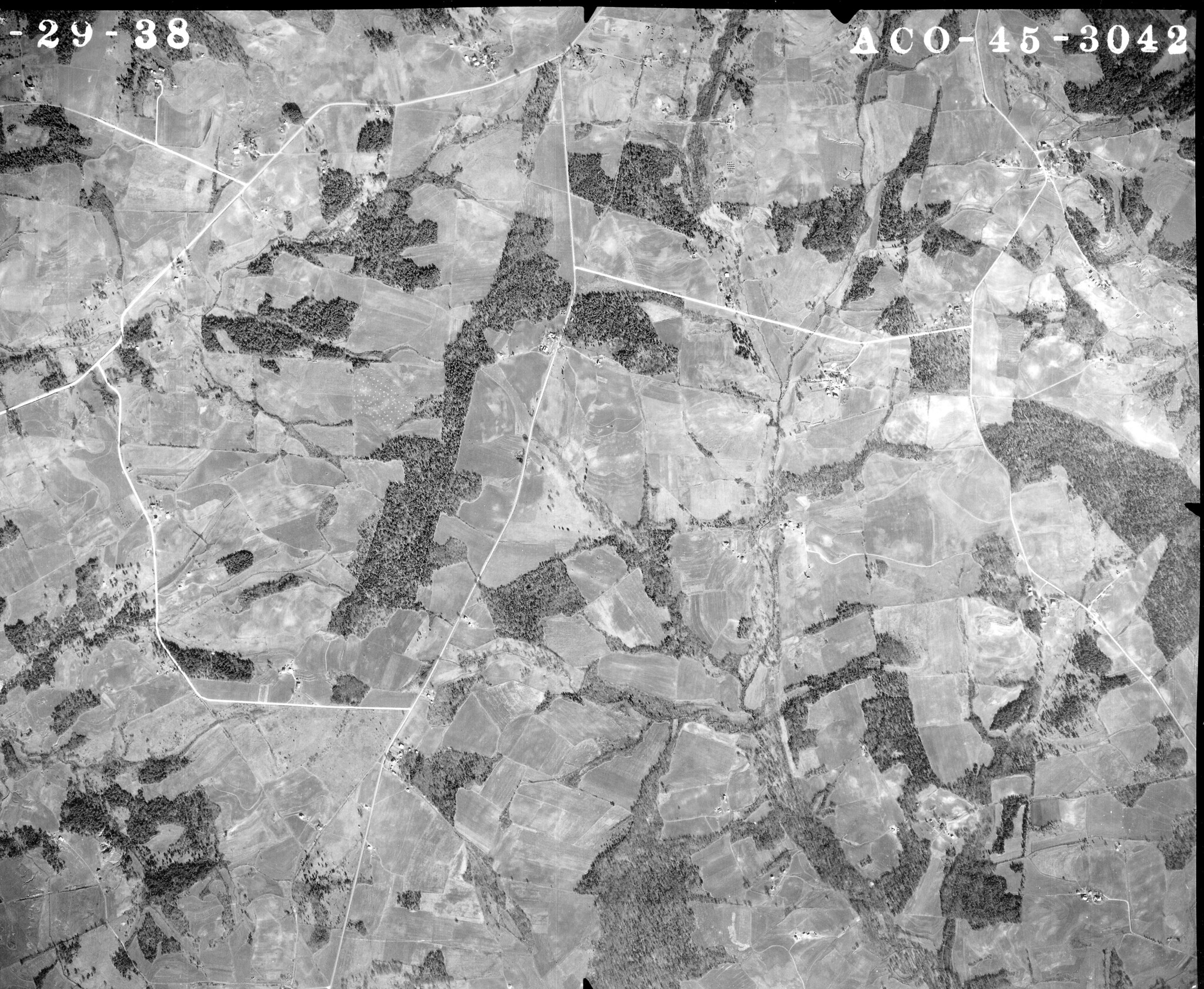
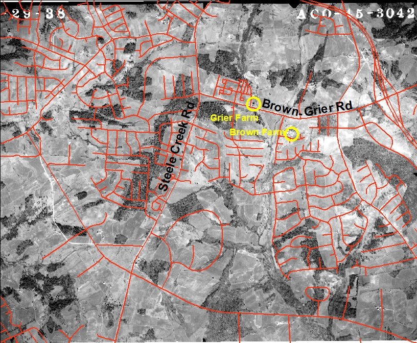
View 1938 Aerial Photographs of Steele Creek (May 22, 2020) The North Carolina State Archives has posted over 200 aerial photographs of Mecklenburg County taken in 1938 on a Flicker page. About 20 of them are in Steele Creek. Former Steele Creek resident Kent Ashton put together an index to identify the geographic location of the photos within Mecklenburg County. The photos on the Flicker page are available at this link: Mecklenburg County Aerial Photographs 1938. View the index here: Mecklenburg 1938 Aerial Photography Index. You can find a particular photo of Steele Creek using roads listed in the index, If you copy and paste the latitude and longitude into Google Maps it will locate you in the present day center of the photo. About 20 of the photographs cover Steele Creek. Seven of these are shown below, along with a second photograph with current streets superimposed over them. Right click on each image for additional viewing options. As the photographs show, there was little in Steele Creek in 1938 besides farms. The current neighborhood streets were not there, and many of the major roads were not there or were not in their current locations. ACO-45-3042 - Steele Creek Road/Brown-Grier Road This photograph shows the Brown family farm at the current location of the Griers Fork neighborhood and the Grier family farm where Pringle Square apartments currently are under construction. Note the realignment of Shopton Road West intersection with Steele Creek Road to eliminate the sharp curve.
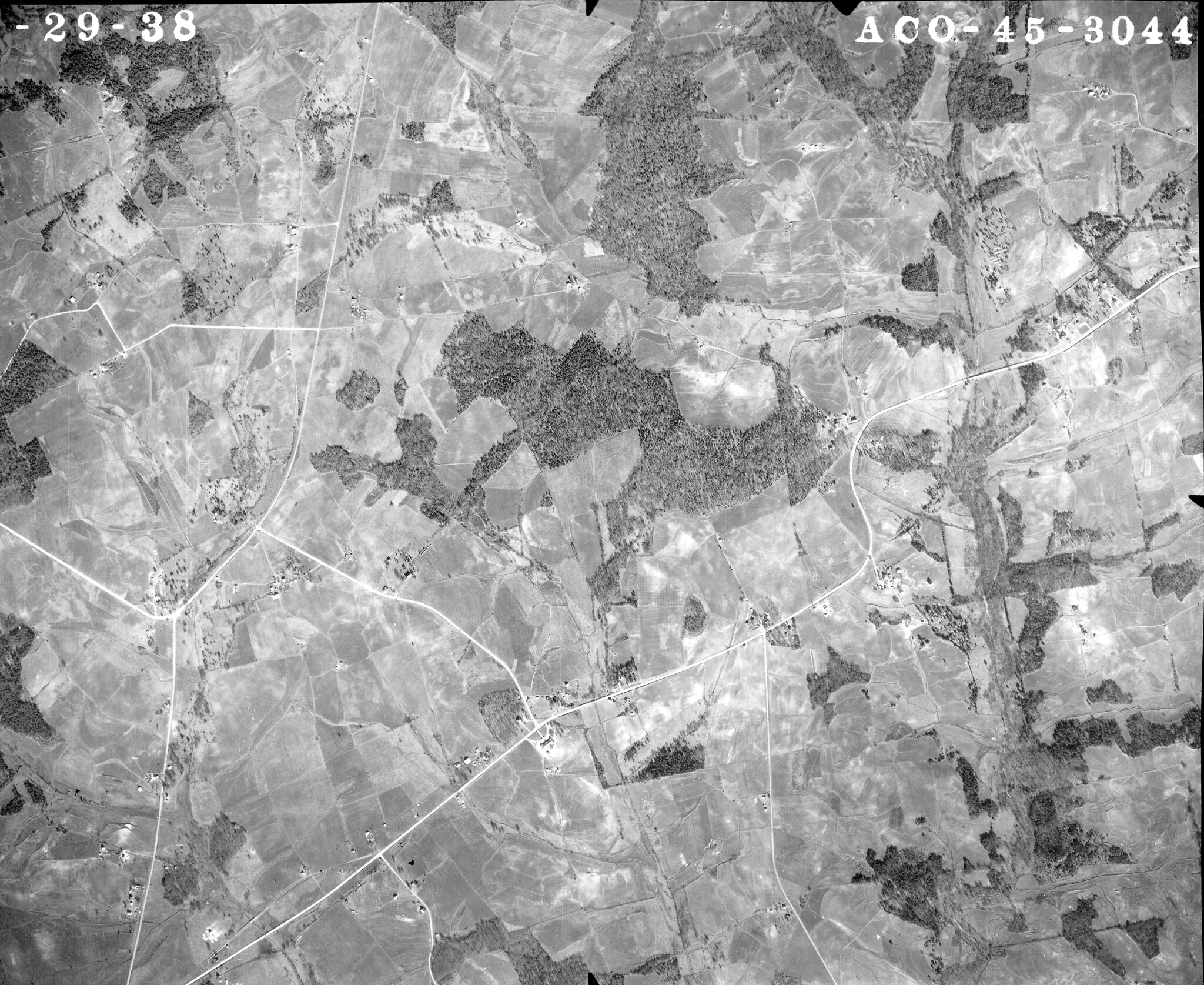
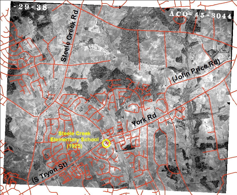
ACO-45-3044 - Steele Creek Road/Erwin Road/York Road (South Tryon Street) This photograph shows the area northeast of the intersection of Steele Creek Road and York Road. York Road followed the current location of John Price Road. York Road has been renamed S Tryon St as Charlotte has annexed pieces of it. The old Steele Creek Elementary School (built in 1925) was on York Road across from Erwin Rd. See Gala to Raise Funds for Steele Creek Elementary School.
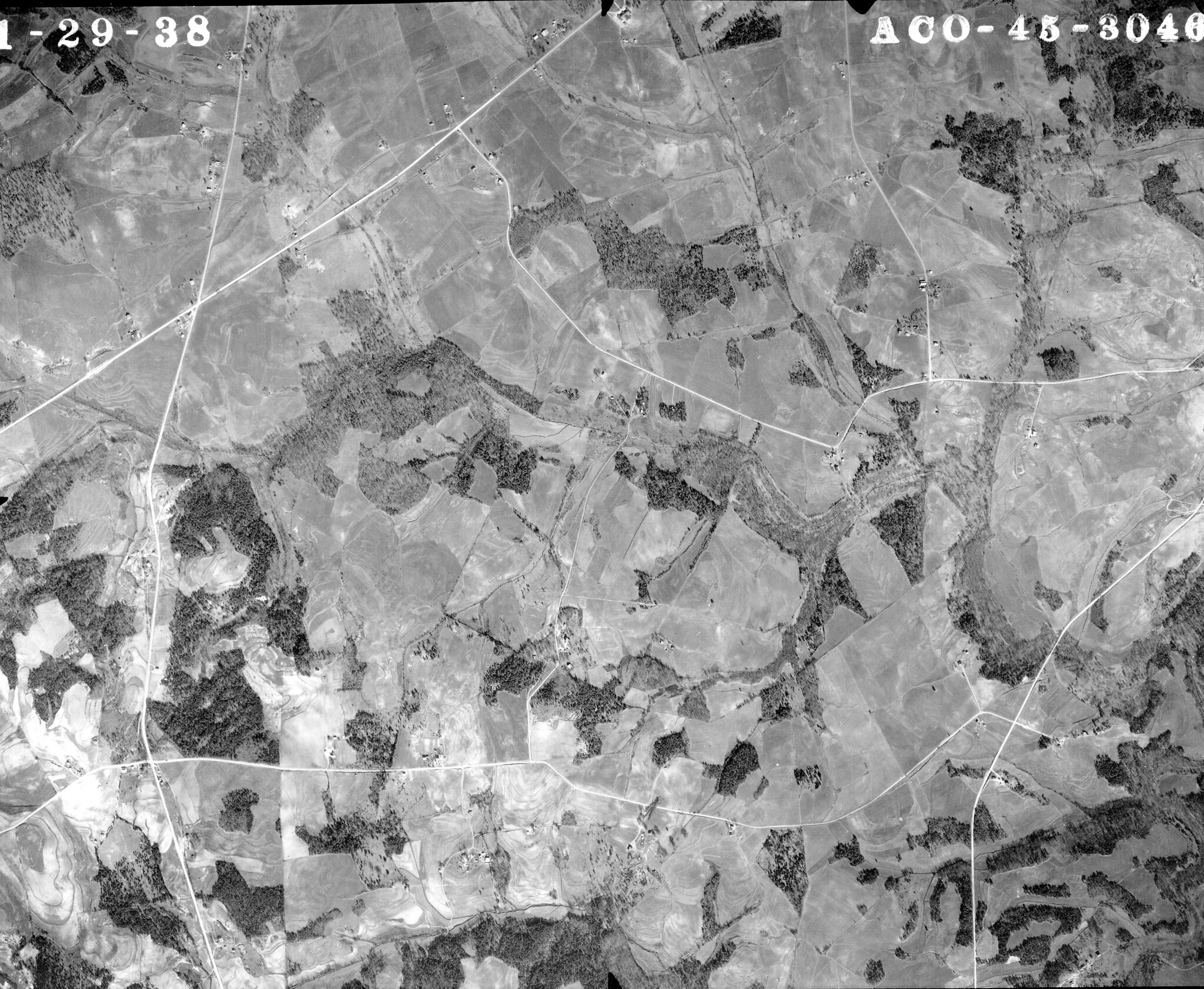
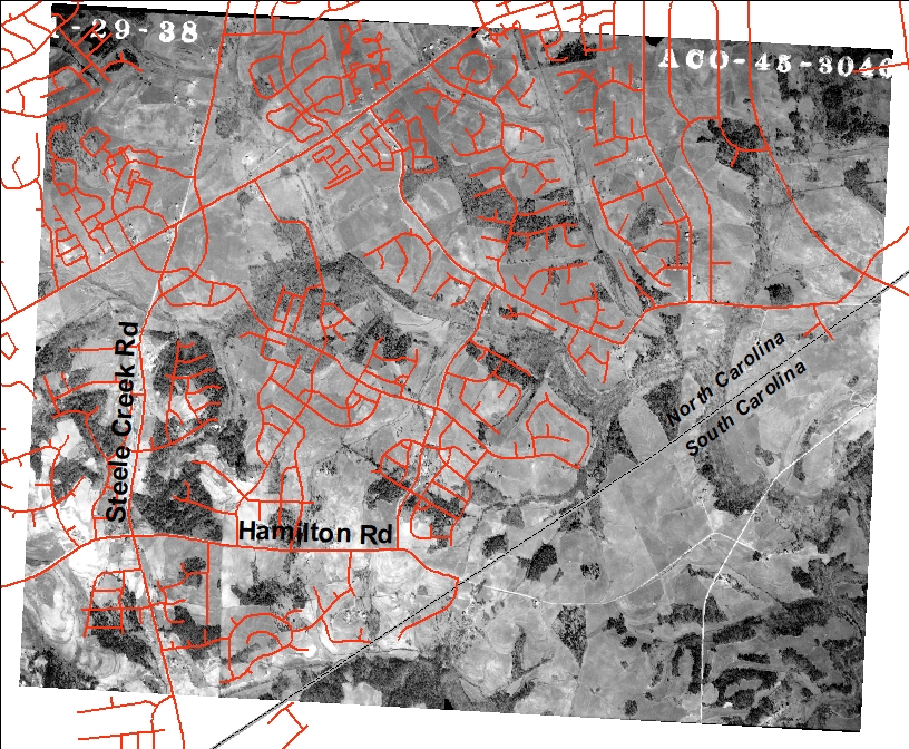
ACO-45-3046 - Steele Creek Road/Hamilton Road This photograph shows the area around Hamilton Rd east of Steele Creek Rd.
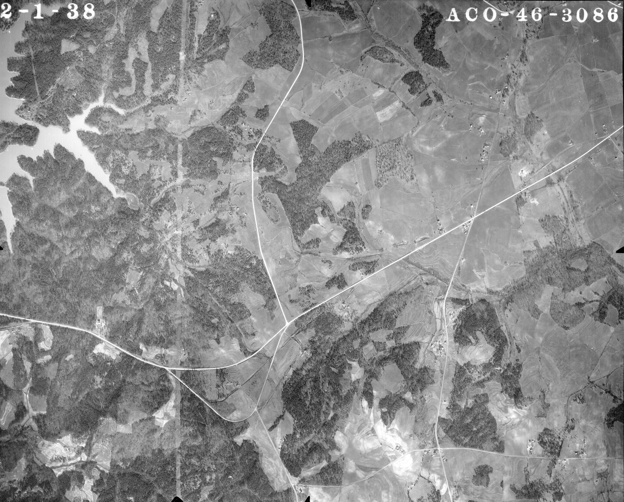
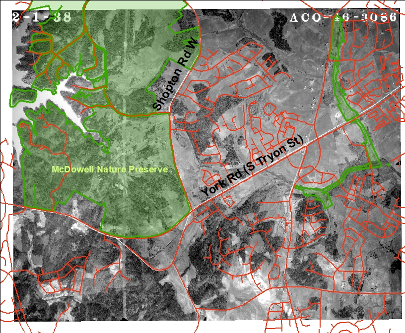
ACO-46-3086 - Shopton Road West/York Road (South Tryon Street) This photograph shows the area around the intersection of York Rd and Shopton Rd W, including much of current McDowell Nature Preserve.
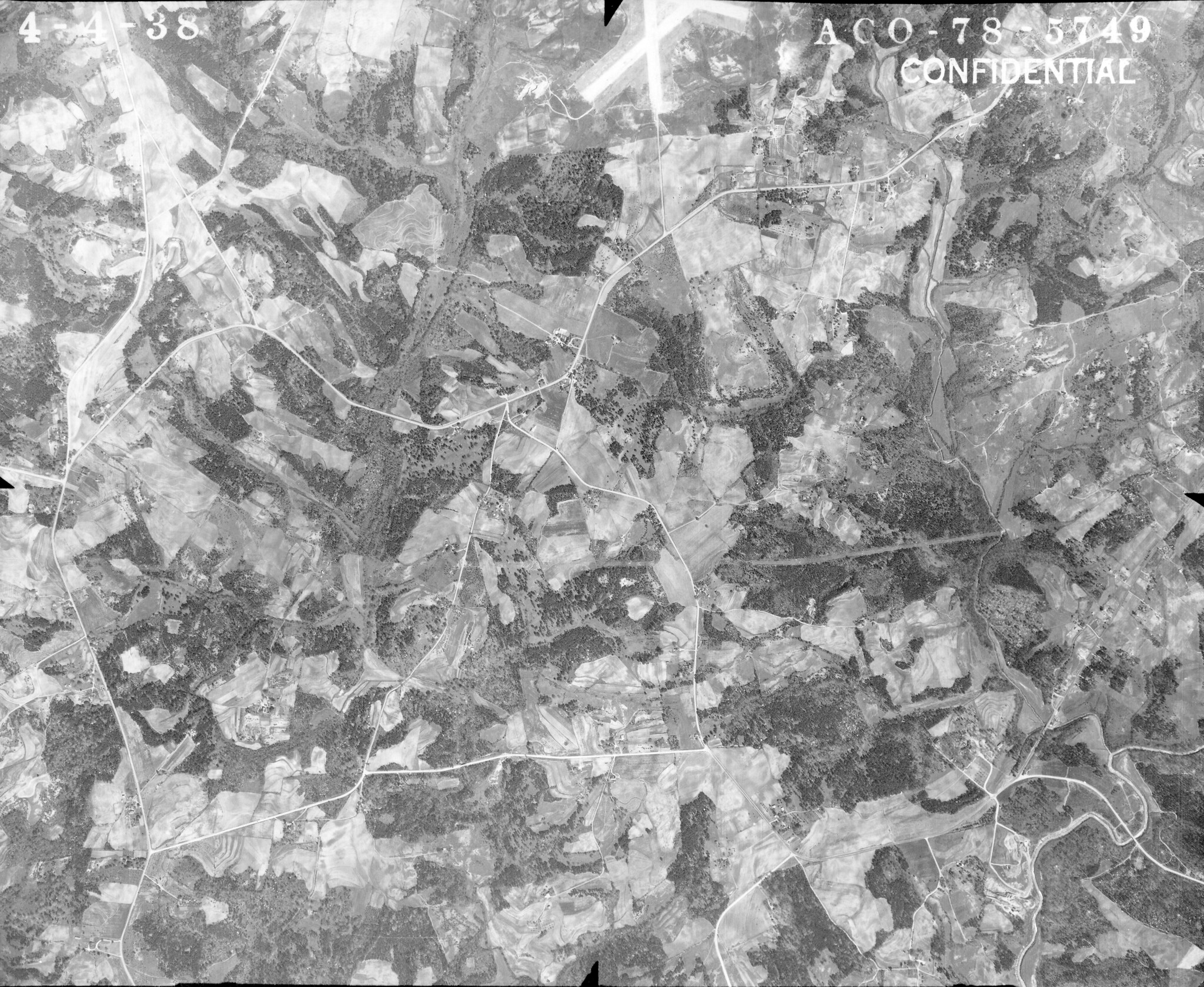
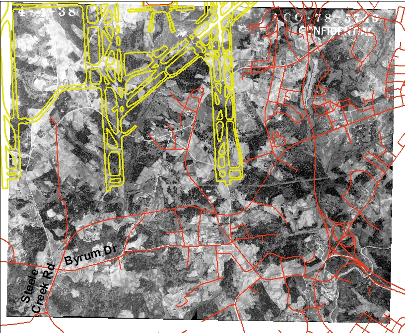
ACO-78-5749 - South of Charlotte Douglas Airport This photograph shows the area south of the airport. The original runway is visible at the northern edge of the photograph.
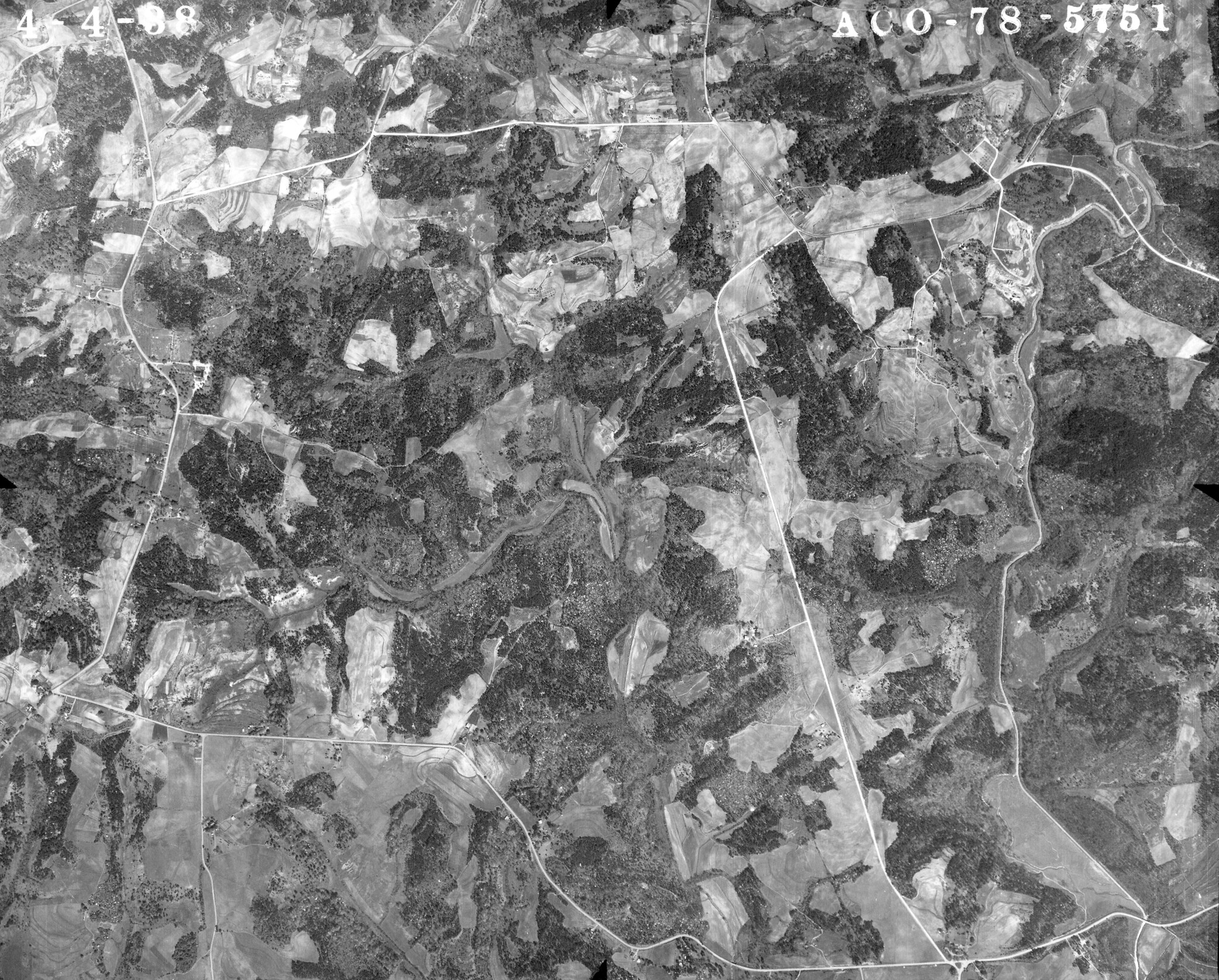
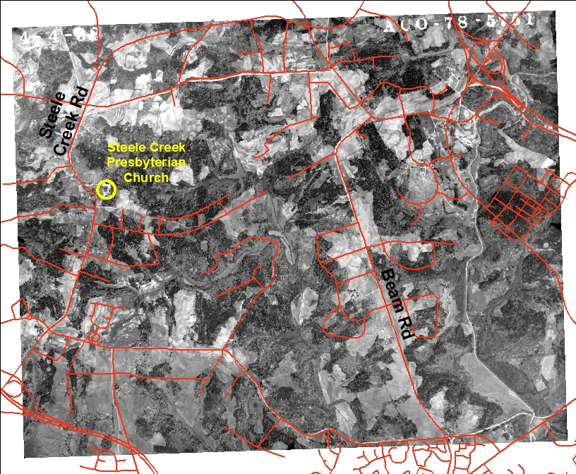
ACO-78-5751 - Steele Creek Road/Beam Road This photograph shows the area between Steele Creek Rd and Beam Rd, including the Steele Creek Presbyterian Church. This church was organized in 1760 but was sold recently to the City of Charlotte due to airport encroachment.
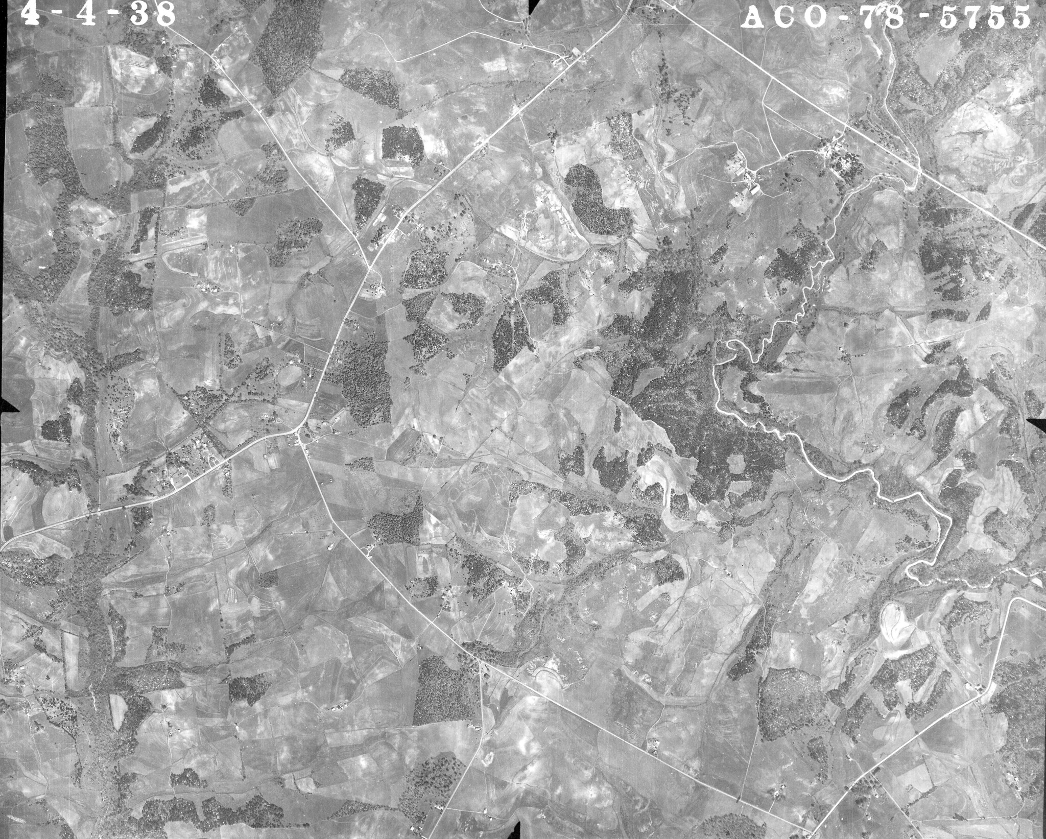
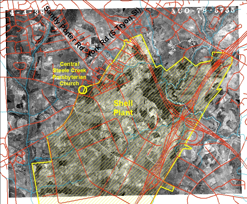
ACO-78-5755 - York Road (South Tryon Street)/Arrowood Road This photograph shows the area southeast of York Rd (S Tryon St) and southwest of Arrowood Rd. Much of this land would change significantly in four years when the U.S. Government purchased 2260 acres for the construction of a Naval Ordinance Plant, or the Shell Plant. This major facility in rural Steele Creek eventually led to Steele Creek currently having the largest industrial area in North Carolina. See Why Do We Have So Much Industry? It All Started with the Shell Plant.
To comment on this story, please visit the Steele Creek Residents Association Facebook Page. |