|
|
STEELE CREEK NEWS
Airport
Prepares to Update Noise Exposure Maps
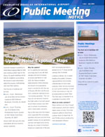
(July 13, 2014) The
Charlotte Douglas International Airport Public Affairs
office distributed a Public Meeting Notice containing the following
information:
Charlotte Douglas is updating its 2006 Noise Exposure Map for
2015 and creating a 2020 map for the future. Six public meetings
will be held for neighbors surrounding the Airport to gain
information about the process, methodology and voice their opinion.
The first set of meetings will be held:
-
6 p.m. - 8 p.m. Wednesday, July 30 at West Service Center,
located at 4150 Wilkinson Boulevard, Charlotte, NC 28208 and,
-
6 p.m. - 8 p.m. Thursday, July 31 at Steele Creek Presbyterian
Church, located at 7407 Steele Creek Road, Charlotte, NC 28217.
Airport staff, land use and noise consultants will be on hand to
answer questions.
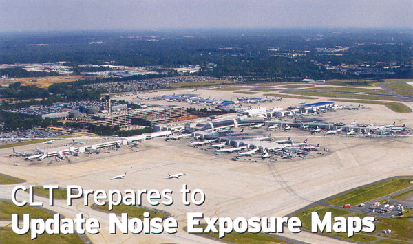
Why the update?
CLT is updating its noise exposure maps due to aircraft fleet
changes and recent changes in runway operations. In July 2013, the
Federal Aviation Administration (FAA) informed the Airport of an
operations issue in connection with the use of Runway 18C/36C and
Runway 5/23, commonly referred to as a "converging operation." The
runways do not intersect, however, the flight paths of aircraft
operating on these runways may intersect in certain circumstances,
which raised safety concerns.
Due to this issue, the FAA temporarily suspended the converging
operation and used only the three parallel runways for all
operations (arrivals and departures) during the day. As a result of
the FAA's temporary suspension of Runway 5/23 converging operations,
demand on CLT's three parallel runways has increased.
Landrum & Brown, Inc. is spear-heading the update. Company
representatives have already collected data to form noise contours,
which will be presented at July's public meetings. A draft of the
noise exposure map will be made public by winter 2014. The final map
is scheduled to be completed in summer 2015.
What
are noise contours?
Noise contours are lines of equal noise exposure, which are used
to depict areas of noise. The noise exposure patterns show three
contour levels of impact 65, 70 and 75 DNL and are produced by FAA
developed software.
What are the goals of a Noise Exposure Map?
Noise Exposure Maps quantify aircraft noise and identify land use
incompatibilities that exist today and in the future, educate the
public about the Airport and activity that occurs at the Airport,
and enable land use planners to make decisions about future
development to ensure noise compatibility.
How are noise levels presented?
Noise levels are presented in terms of the Day-Night Average Sound
Level (DNL) metric, which is a function of the loudness and
frequency of noise events on an average-annual day. DNL adds a 10
decibel penalty to noise that occurs at night (10 p.m. - 6 a.m.). A
65 DNL is the level at which noise-sensitive land uses are
considered to be incompatible without treatment to reduce interior
noise levels (sound insulation).
How long is noise data collected?
Existing noise conditions are based on 12 months of data. Future
condition projects noise levels five years into the future and take
into account any changes (physical or operational) that may have an
effect on the noise levels around the airport.
Please direct
questions to the Charlotte Douglas International Airport Public
Affairs Office at 704-359-4000.
To comment on this
story, please visit the
Steele Creek Forum.
Click here:
to share this story to your Facebook page,
or click below to visit the Steele Creek Residents Association
Facebook page.
.
|