|
City Council Action on Steele Creek Area Plan Deferred
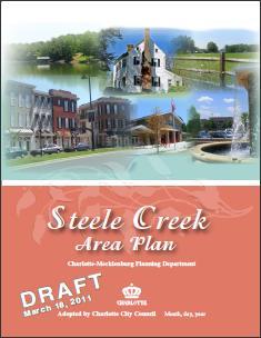
Planning Department staff met with approximately 40 citizens from The Sanctuary and other nearby neighborhoods on Tuesday, December 6th to discuss the draft Steele Creek Area Plan and pending rezoning, Petition No. 2011-065. (The petitioner has requested that this rezoning petition be deferred until February 2012). At this meeting, citizens shared concerns about recommended densities along the Catawba River in the draft plan, the requested density in Rezoning Petition No. 2011-065, water quality, schools, and transportation. The Citizens Advisory Group, which has been involved in the development of the Steele Creek Area Plan for two and a half years, was not notified of this meeting. Sanctuary-area residents became interested in the area plan after the rezoning petition was filed for the area. Some citizens indicated that they were not aware of the planning process while others noted they did not realize the importance of participating in the planning process. This item will be brought back to the Transportation and Planning Committee of the City Council and to the full Council early next year. The Draft Steele Creek Area Plan is available on the Planning Department's web site here: Steele Creek Area Plan. Revisions to the draft plan are listed in the document Steele Creek Area Plan, Potential Revisions to Draft Plan, dated September 19, 2011. An additional recommended change is to add language recognizing the historical significance of retaining the name York Road instead of changing it to South Tryon as property is annexed into the City. This does not mean that the name change will not occur. However, the document will recognize the significance of the name. Planning Department staff also have made revisions to several of the maps in the draft plan. These are not posted on the Planning Department web site but are available below. View other revised maps using the links below:
Revised Map 2 - Concept Map Planning staff will schedule another meeting of the Citizens Advisory Group to discuss the issues brought up by the Sanctuary-area residents and additional changes soon. To comment on this story, please visit the Steele Creek Forum. |


 (January
5,
2012) The Charlotte City Council was scheduled to take action on the
draft Steele Creek Area
Plan at the
December 12th Council meeting. However, this item was removed from
the agenda to allow Planning Department staff to work with citizens
in The Sanctuary and other nearby neighborhoods to address their
concerns.
(January
5,
2012) The Charlotte City Council was scheduled to take action on the
draft Steele Creek Area
Plan at the
December 12th Council meeting. However, this item was removed from
the agenda to allow Planning Department staff to work with citizens
in The Sanctuary and other nearby neighborhoods to address their
concerns.